Glensaugh: Soil Texture in Nitrate Vulnerable...
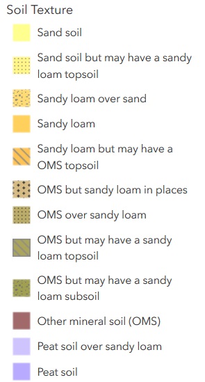
The map shows soil texture in the Nitrate Vulnerable Zone in Glensaugh farmland and its environs. It provides information to help understand what management practices can be performed, and when, within Nitrate Vulnerable Zones (NVZs).
For the spatial data of the map click link below for download:
https://www.hutton.ac.uk/sites/default/files/files/glensaugh/Downloads/Glensaugh_NVZ_SoilTexture.zip
Additionele informatie
| Veld | Waarde |
|---|---|
| Data laatst gewijzigd | 21 mei 2020 |
| Metadata laatst gewijzigd | 21 mei 2020 |
| Gecreëerd | 21 mei 2020 |
| Formaat | WMS |
| Licentie | Other (Open) |
| Has views | True |
| Id | ed0b7cce-b9fa-431c-9f72-56e9255d9535 |
| Package id | 30805668-9c53-402f-8049-f1672832450b |
| Position | 8 |
| State | active |