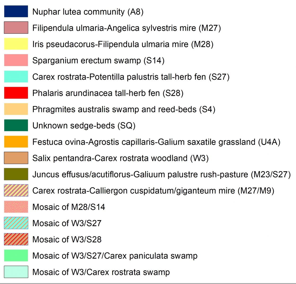
Chapel Mires wetland cover map
This is the map generated from the mapping of Chapel Mires floodplain wetlands of Lunan catchment. It was produced from a rapid appraisal of National Vegetation Classification (NVC) classes over the site combined with RTK-GPS and aerial imagery in June 2017.
Papildoma informacija
| Laukas | Reikšmė |
|---|---|
| Data last updated | 2019 m. rugsėjo 20 d. |
| Metadata last updated | 2019 m. rugsėjo 20 d. |
| Sukurtas | 2019 m. rugsėjo 20 d. |
| Formatas | WMS |
| Licencija | Other (Open) |
| Has views | True |
| Id | 7ee68655-ac10-4c51-901e-e89f7b842187 |
| Package id | 3d5cc51f-080a-40c2-aebd-b888e51a89a9 |
| Position | 2 |
| State | active |